Hiking the Quilotoa Loop
Llamas, river crossings, and unexpected cow caca

We are a little behind on writing updates from our travel but here is a write-up of our multi-day hike in Ecuador at the beginning of November.
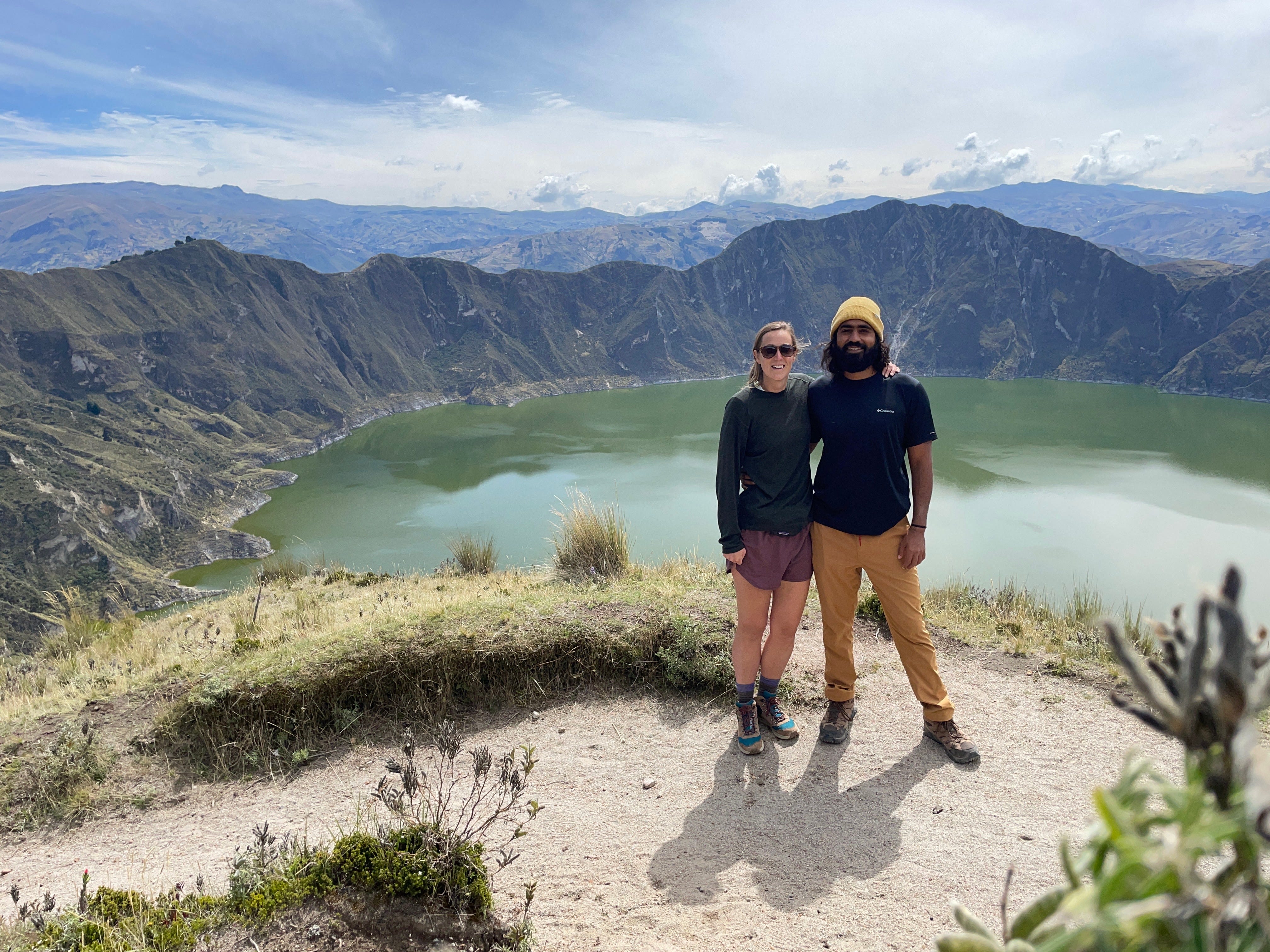
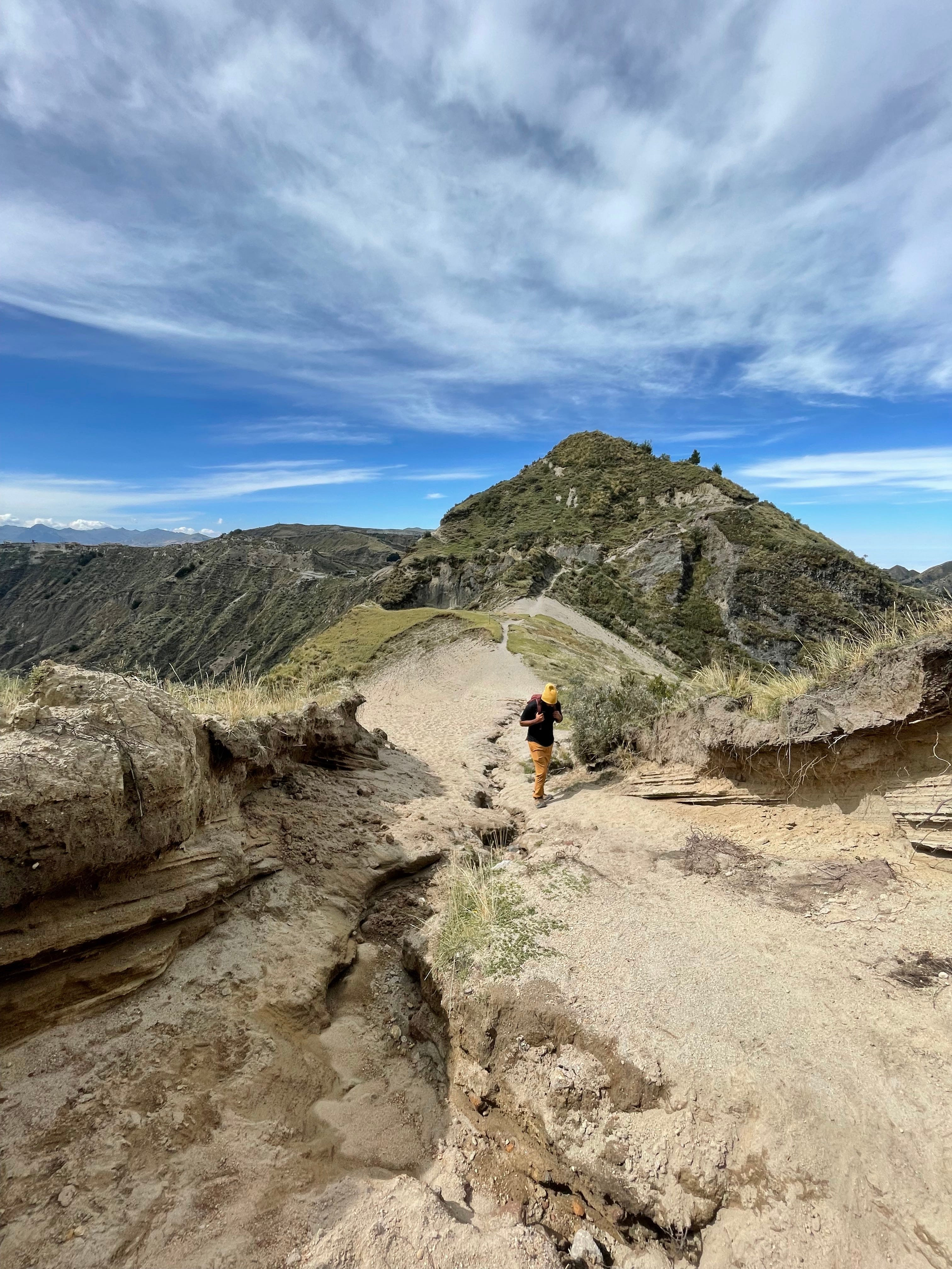
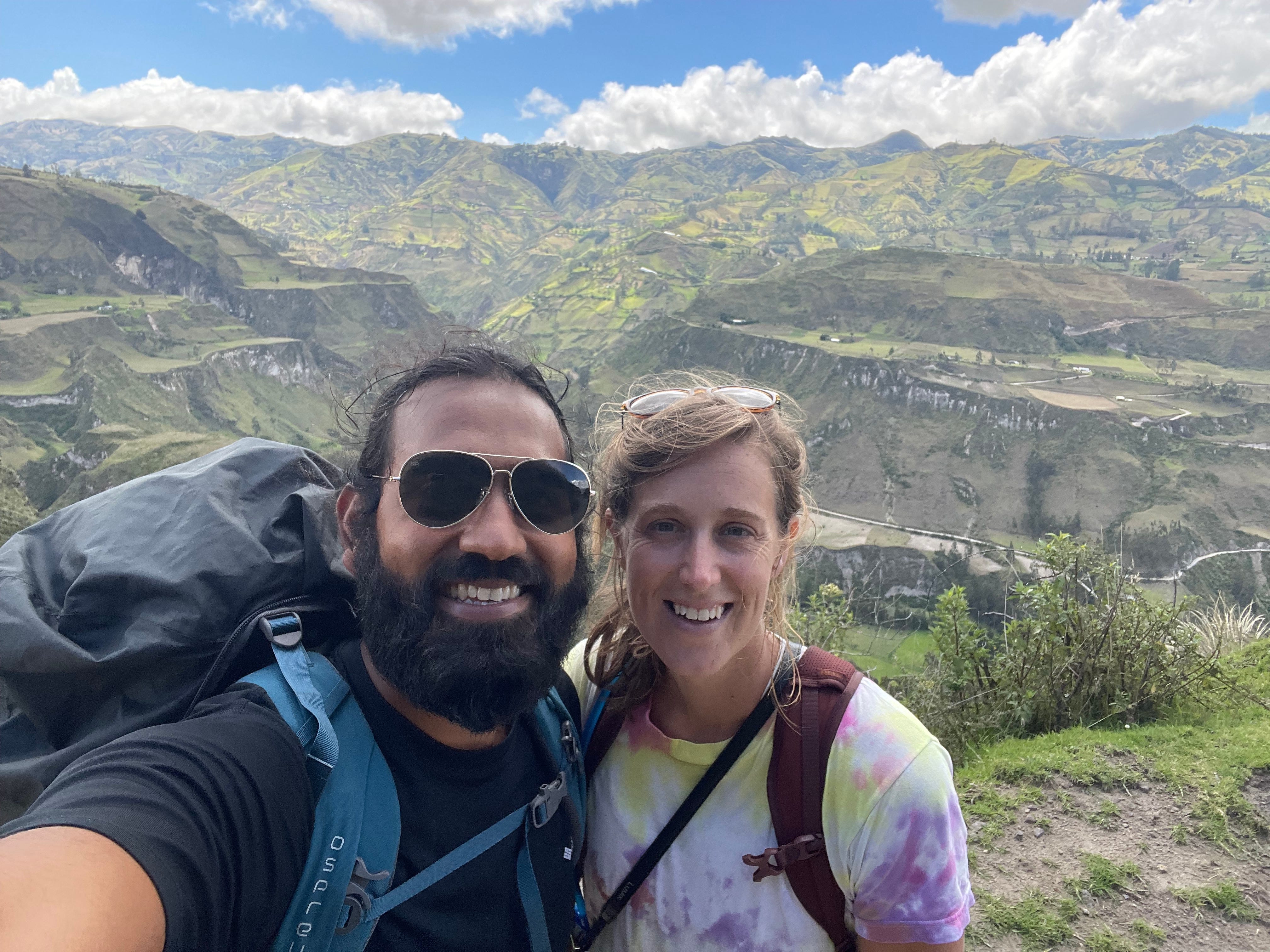
We had come to the Cotopaxi region to spend four days and three nights hiking through the Quiltoa loop, home to an absolutely breathtaking trail that connects remote indigenous villages in the high Andes of Ecuador. Each day on the loop takes you across deep valleys and through rolling green hills and finishes at the hazy green-colored crater lake and volcano, Quilotoa, that was created in 1280. And the best part is you will likely only have to compete for the trail with your fellow llamas.
A bit of history…
Historically this route was an important trading route where merchants of the different ethnic tribes of the Yumbos and the Sigchilos would meet each other to trade goods from the coast to the Andes. This area was highly valued by both the Incas and the Spanish due to its rich agriculture and the presence of gold and silver mines. The history is unfortunately similar to the rest of the Americas, where the indigenous people were enslaved, first by the Spanish and then by the owners of the large haciendas after Ecuador got its independence in the 1830s; it was not until the 1970's that the indigenous people got their land back. Today the majority of the people that live here are Kichwa (the indigenous population) and still speak the native dialect. Unfortunately, most people live in extreme poverty (less and $1 a day) as the income from agriculture is very limited.
The hike....
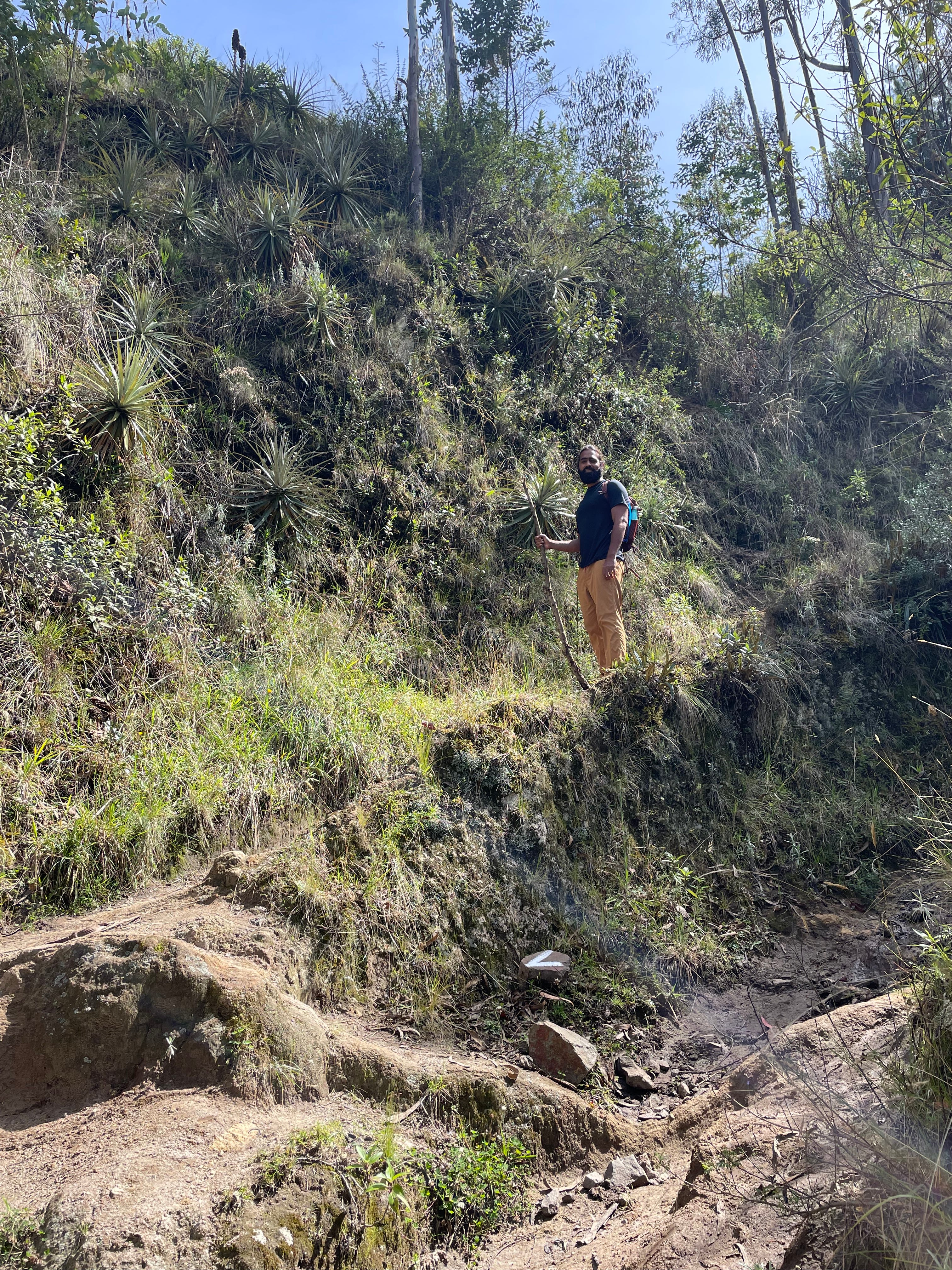
Was tough, to say the least. And we got lost A LOT, and ended up spending the last three hours of our hike on the "animal route" scaling the inside of the crater lake .... but in the end, it was totally worth it!
Route: Sigchos > Isinlivi > Chugchilan > Quilotoa
On the first day as we stood at the bottom of a valley surrounded by a green expanse, we had a decision to make. We were at a crossroads (the first of many) to our left we could follow the road uphill following signs to “Llullu Llama” where we were staying that night or we could turn right following a smaller trail or “sendero” and follow my 'mapsme' directions (an app for offline maps) which to that point had steered us correctly, capturing every turnoff taken so far and had been our only source of truth as trail signs are few and far between.
At this point, I (incorrectly) believed, with absolute certainty, that we needed to follow my offline directions despite both Dinesh and the road sign with our hostel's logo telling us to go the other direction. For those of you who had traveled with me previously, direction have never been my strong point.
The path lead us along an relatively flat trail for a few hours passing through a small village before sharply turning straight uphill. At this point, the ascent was extreme and at an altitude of roughly 10,000 ft it was difficult not to feel the impact of the altitude resulting in the need to rest every few minutes. After a few breakdowns and a much needed snack break, we summited. Although not this route was not incorrect, the other way (the way Dinesh wanted to go) was likely the best choice.
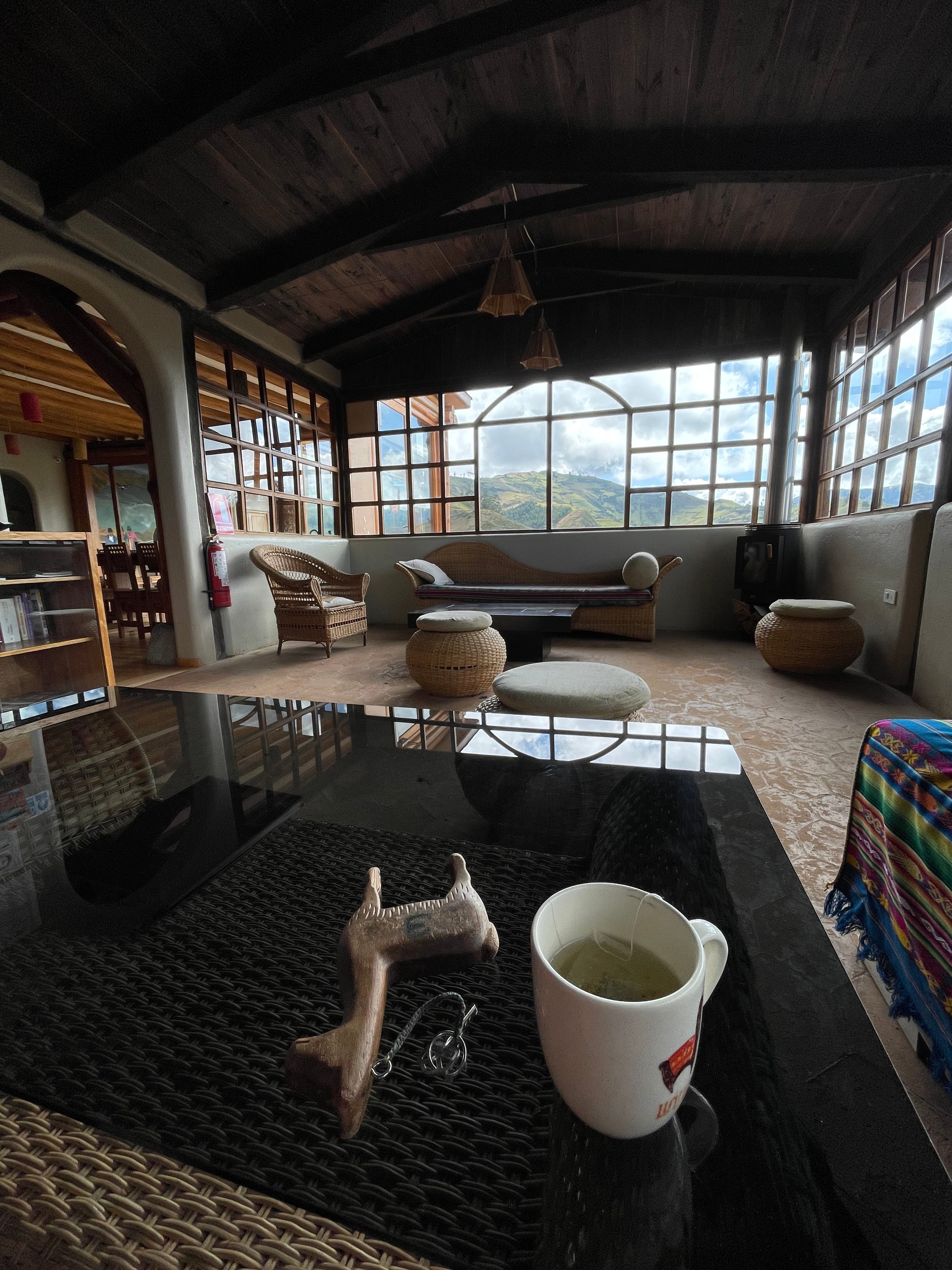
After 5 or so hours of hiking, we saw the town of Isinlivi, a very much a welcome sight, this town is home to Llullu Llama lodge, the most beautiful lodge of our hike and trip so far. The original farmhouse was built in 1900 and is the only lodge along the hike in an original structure. The current owner bought the lodge in 1990 and has done an incredible job renovating it, and is a showcase of local indigenous artists and furniture makers. Outside the dining area is a living room area with expansive views out to the green valley - its hard not to admired the intricate pattern of agricultural fields that expand in all directions. After getting settled in our room and taking a much-needed shower, Dinesh and I curled up in one of the couches with hot tea and a good book. Although there were only a few guests (as a result of the pandemic), dinner was served family-style or at individual tables if you preferred. We joined a family table with a solo hiker from the Netherlands and a couple (German and American) who had just recently reunited after not being able to see each other for the last year and a half due to the pandemic. After hiking solo all day we were happy to be in the company of others and reminisdt on the day’s adventure.
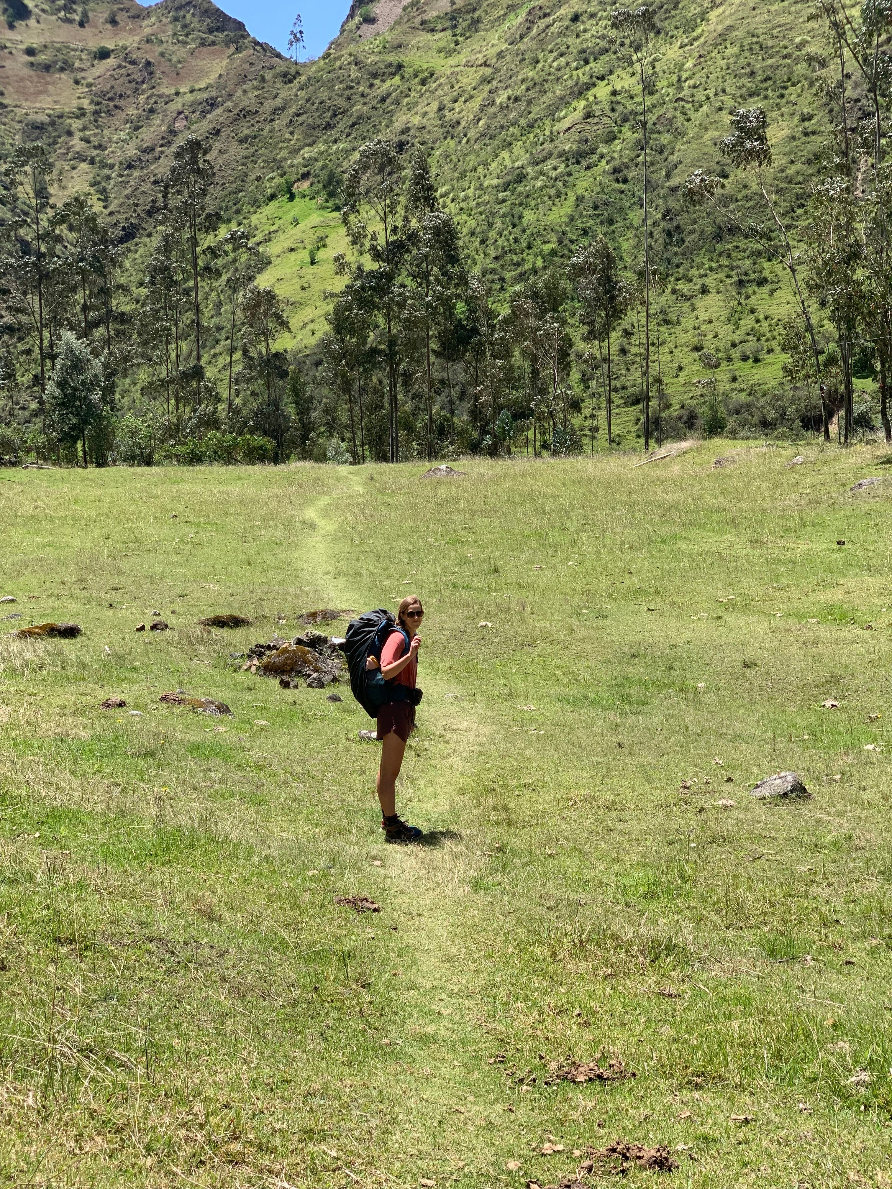
Overall this trip was full of guilty pleasure that I was not used to on multi-day hikes. The first was getting to hike through the mountains during the day and then stay in warm lodges each night eating delicious food prepared for us. The second was not having to carry sleeping supplies (tent, sleeping bag, and cooking gear). We only had to carry our personal items that we may need for three days, which may seem like it would be light, but given we were here during the rainy season and the temperature in the Andes oscillate significantly each day our bags still felt quite heavy. We definitely did not want to get caught unprepared as we were hiking without a guide and in rainy season, luckily we managed to escape the rain.
There were also some challenges..one being the altitude, the hike started at 9,500 ft, and each day we descended and ascended around 2,500 ft. This amount of elevation change is nothing drastic - but was caught of guard at how much the altitude affected me. There were some parts of the hike where I needed to rest every few steps and felt like I was bearly moving (more like a shuffle then hiking). At one point, I had stopped to catch my breath when an older (~75 yrs old) woman from the village who was tending to her animals passed us, she went off trail for a moment and come back with a stick that she then handed to me saying “For you, you’ll need this” before passing us both on her way up the steep incline. I was constantly surprised at both the incredible generosity and the strength of the people we encoured along our journey.